ExploreOngoing inquiry
The Miami structure
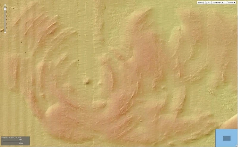
In 2012 I noticed a circular feature in a map of the seafloor off Miami, and I have been trying to understand it ever since. I think an impact deserves consideration. The published field research reached a different conclusion, and both belong in the account.
Something in the map
I was exploring NOAA's bathymetric viewer when the feature caught my eye. Bathymetry is a map of depth; it shows the shape of the ground beneath the water. In this one, the feature is a set of curved ridges around a central area, with a different pattern from the longer, straighter relief nearby. It sits just outside the busy entrance to Government Cut, close to Miami Beach and Fisher Island. That contrast is part of the appeal: an unusual piece of ground right beside one of the most heavily used stretches of water around Miami.
My geology studies helped me see why the shape looked familiar: it resembled an impact structure. I didn't collect the survey data. I was looking at NOAA's work and noticed something in it. Correspondence about the feature followed, including discussions in 2015, and a first look turned into a question that has run through more than a decade of my life.
A resemblance is not an answer
Geology, mineralogy and structural geology at New Mexico Tech gave me ways to think about the pattern, but a resemblance can't settle where something came from. A circular feature can have more than one explanation.
I have spent years looking for reasons the impact interpretation might be wrong. Over that time I have become more persuaded it could be an impact structure. That is my interpretation of an unresolved question. It is not an established identification of a meteorite crater.
The work has involved maps, published research, correspondence and a lot of reading and reconsidering. I have kept writing about it, including a manuscript linked from the Crater Explorer entry, so anyone interested can read it alongside the research that argues against it.
What the divers found
In June 2020, Antonio J. Paris, Ryan Robertson and Skye Schwartz investigated the structure by SCUBA and collected 30 geological samples from different parts of the feature.
Their paper reported that the samples they examined did not contain the shock features or meteoritic material they were looking for. They concluded it was a solutional doline, a depression formed as rock dissolves.
That is a serious competing explanation, and I continue to weigh the impact idea against it.
The sand survey and the core
William C. Aley IV's February 2021 presentation came out of SAD-SAND, a larger search for offshore sand resources. It described 52.5 line-miles of geophysical data in the vicinity, collected with several methods for looking at the bottom and what lies beneath it. It was a sand investigation, not a survey devoted to the feature.
His slides include magnetic observations and images meant to show material below the seafloor. One section is explicitly described as inconclusive because the equipment didn't penetrate far enough.
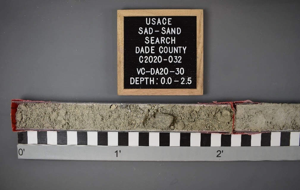
The photographed core is labeled VC-DA20-30, from the USACE SAD-SAND Search in Dade County: four sections of sediment from the surface down to ten feet, with a ruler and labels showing where each belongs. That was sediment sampling. My separate discussions about drilling into bedrock concern a different investigation, one I would still like to see happen.
Where it stands
Maps, surface samples and the sediment core give different views of the feature. I would still like to investigate the underlying rock. My impact interpretation remains unconfirmed, and the 2020 field study is essential reading alongside it.
I first noticed the feature and have continued independent analysis of the impact hypothesis and other explanations.